Happy New Year!
We just watched the New Year's celebration on Chinese television, straight from Guangzhou. A fifth of the world is already in next year!
I hope you have a good one!
We just watched the New Year's celebration on Chinese television, straight from Guangzhou. A fifth of the world is already in next year!
I hope you have a good one!
Christmas Eve, we drove down to my parents' house. We passed downtown as the sun set.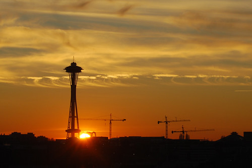
Christina drove, so I took some photos.
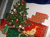
The tree wasn't quite completely decorated, so we helped.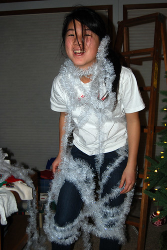
And then we had cake. It was two days before Christina's birthday, after all.
Christmas morning dawned foggy and frosty.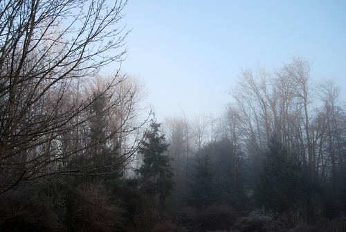
Cookies were eaten.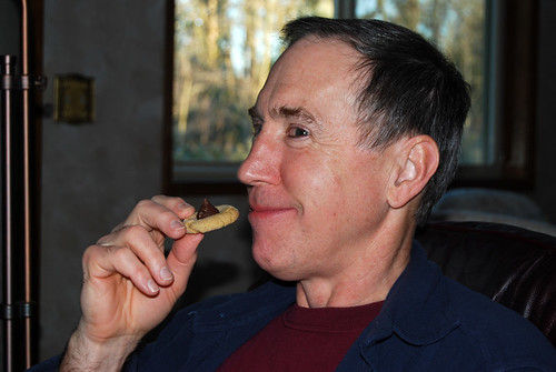
Gifts were opened.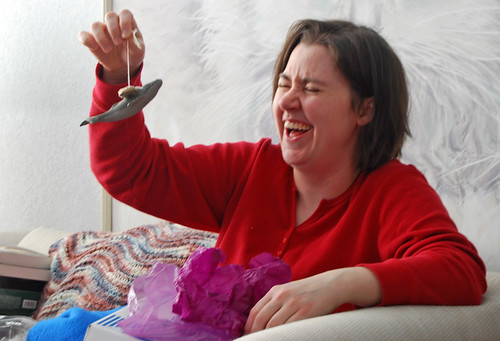
'Twas a jolly time for all!

Then we took a break for afternoon breakfast.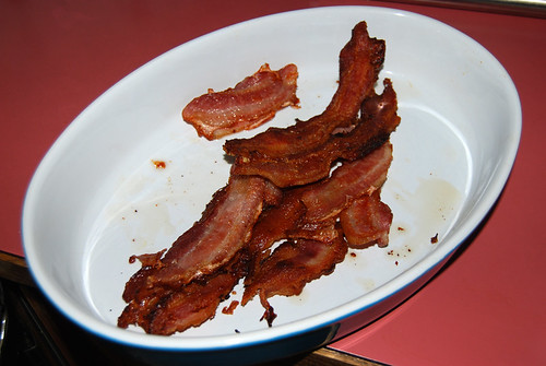
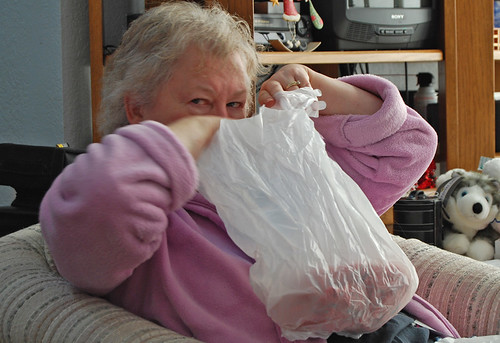
Afterwards, Mom's sister and family arrived. 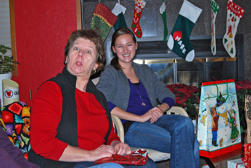
We had a gift exchange which somehow resulted in Dad opening half the presents.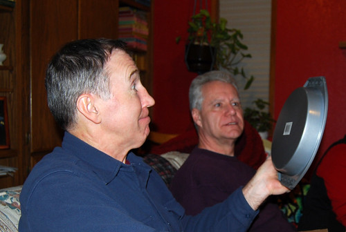
Next came dinner, followed by dessert. During which, Amy committed food abuse. Oh, the horror!
I made sure to document it, of course.
Merry Christmas!

The Year of the Eagle has ended and thus begins the Year of the Orca! Happy New Year!
Today is also the Holy Day of Kérasa, for every New Year's Day is Her holy day.
May She bring peace and fertility to you in the coming year. May She make the universe a better place through you.
And now for the annual photo of our tiny, artificial tree and a huge pile of Christmas presents around it.
We put the tree on a table this year so we could see it better. It's harder to stack gifts nearby, though.
Merry Christmas!
After reading that eastern Maine has the solar system modeled to scale along US Route 1, with 1 mile covering 1 astronomical unit (the distance from the earth to the sun) (scale 1:93,000,000), and that Sweden has the largest solar system model (scale 1:20,000,000), I figured that something bigger and better needed to be built, with the sun in Seattle, naturally.
From the length of Interstate 90 from Seattle to Boston (approximately 3,000 miles), I decided that a good scale for the model would be 1:1,860,000, or 50 miles per 1 astronomical unit. Here's a summary of how it would look:
Sun -- centered at Space Needle, 2400' diameter
Mercury -- Issaquah or Preston (20 miles), 9' diameter
Venus -- east end of North Bend (35 miles), 21' diameter
Earth -- Snoqualmie Pass (50 miles), 22' diameter (with Moon, 6' diameter @ 600')
Mars -- Easton or Cle Elum (75 miles), 12' diameter
Ceres -- Vantage (135 miles), 10" diameter
Jupiter -- Cheney or Spokane (260 miles), 250' diameter
Saturn -- Missoula (475 miles), 200' diameter
Uranus -- Buffalo, Wyo. (980 miles), 90' diameter
Neptune -- Mitchell or Sioux Falls, S.D. (1500 miles), 87' diameter
Pluto -- Mitchell, S.D. to Eire, Pa. (average Chicago, 2000 miles), 24" diameter
Eris -- Chicago to the middle of the Atlantic (average Boston, 3000 miles), 27" diameter
Sedna -- south of Nova Scotia to over twice around the earth (average Seattle), 30" diameter
The circumference of the sun could be painted on the pavement in the Seattle Center (or built with cobble stones or another different paving type), with a model of Sedna in the Pacific Science Center.
A model of Mercury could be in a park or shopping mall area in the Issaquah area.
Venus could be near the truck stop at exit 34 east of North Bend.
Earth could be in the parking lot beside the Travelers Rest at Snoqualmie Pass, with the Moon near the hotel. When standing by the model of the Earth, the Moon model should look the same size as the real Moon in the sky.
Mars would be at the property of whoever in the Easton or Cle Elum area wants a minor tourist attraction.
Ceres could go in one of the parks or a restaurant in the Vantage area, with possibly some other asteroids nearby.
Jupiter would be painted or paved similar to the Sun, at Eastern Washington University, Gonzaga University, or Riverfront Park in Spokane, unless students at one of the schools decided they wanted to build a huge sphere.
Saturn would either be marked with paving stones around the Grizzly Statue at the center of the University of Montana, or perhaps on the grassy hillside above the campus near the giant M, so it's visible from all over town. I can envision the rings protruding from the hillside as a pedestrian walkway.
Uranus would be constructed wherever in northeastern Wyoming someone will take it.
Neptune would go at one of the small universities in Sioux Falls, or perhaps right next to the Corn Palace in Mitchell. Wouldn't that be nice?
Pluto would go at the Museum of Science and Industry in Chicago, or one of the other museums or universities in Chicago, or perhaps the University of Wisconsin in Madison or Notre Dame or Toledo or . . . whoever takes it.
Eris would be located at the Boston Children's Museum or the Harvard Museum of Natural History or some such.
Each location would have a sign (or maybe multiple signs around the Sun) that describes the whole project and shows where all the planets are.
In summary: wouldn't that be cool?
UPDATE: If none of the museums, universities, or parks near I-90 in the midwest want Pluto, there's always Pluto's Beef and Hot Dogs in Oak Lawn, just west of Chicago!
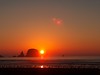
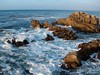
A week and a half ago, after driving the length of US 97 in Washington, Chunlin and I spent the night in Osoyoos, British Columbia.
Here's the view from our hotel room -- top floor of the Holiday Inn.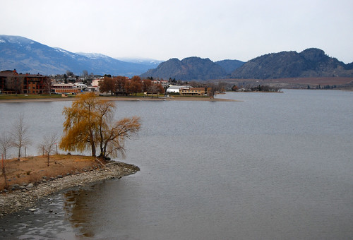
The sun sets pretty darn early this time of year, but we did manage to take a walk before it got too dark.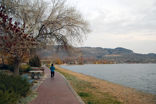
Osoyoos Lake is one-third in Washington and two-thirds in Canada, but it has a couple peninsulas that nearly extend all the way across the lake. Thus it appears smaller than it is, when you're on the shore. Our hotel was on one of the peninsulas, as is the distant row of trees in the photo above.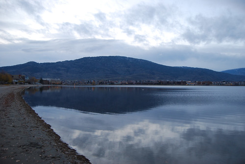
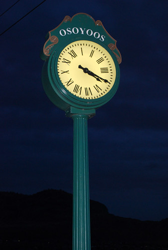
I have to use my flash and it's what time?
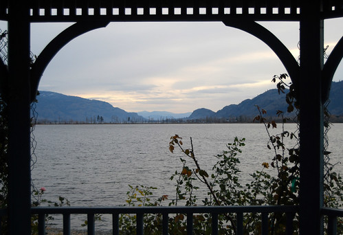
Maybe this will give you a clearer sense of where Osoyoos is in Canada.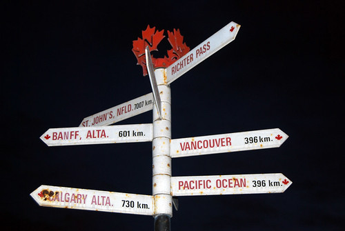
Or you could use a map. . .
There's more photos from that four-day trip on flickr, and I still have a few more to go through.
Hívuítoví seems to be taking Her holy day off from Her work . . . thankfully.
Nuvíní must be nearby. Her crows are swarming the neighborhood. . .
Bing Maps is now officially tied with Google Maps to be my favorite map program. Bing has recently added some click-and-drag functionality that Google has had for quite awhile, while Google has recently fixed some erroneous information (such as removing the Wenatchee Confluence State Park from Snoqualmie Pass!).
Bing has the great bird's-eye view for many areas, but Google has Streetview, contour maps, and better aerial photos for many areas.
The one part where Bing leaves Google far behind is calculating travel times on any road that's not a freeway. Google thinks you need to drive 30 mph on all back roads, even if the speed limit is actually 60!
As for Yahoo Maps and Mapquest, well . . . they can calculate all right, but they're not nearly user-friendly enough. Click and drag, man, click and drag!
They all need to get better at adding new roads, though. Some areas are years out of date.
UPDATE: One feature of Yahoo Maps that the others lack, however, is different colors for different cities and neighborhoods, depending on your zoom level.
A year ago, I drew up a little map showing the unemployment rate in each state.
Here's another one, with the same color scheme:
Green states have unemployment below 4% (none in Sept. '09).
Olive states have unemployment between 4% and 5%.
Yellow states have unemployment between 5% and 6% (none in Sept. '09).
Maroon states have unemployment between 6% and 7%.
Red states have unemployment between 7% and 8%.
Magenta states have unemployment above 8%.
Things don't look so good this year, huh?
What should the government do? Perhaps they should take money away from citizens when the citizens need it most and also make it difficult for business owners to hire new employees? Does that sound good? What, no? Because that's what we're doing. . .
Last Sunday, we stopped by this really huge art installation on Whiskey Dick Mountain in eastern Kittitas County.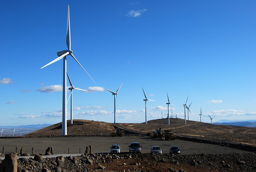
The giant towers had these huge three-pronged blades slowly rotating (although, truth be told, not all of them were spinning). The sign at the gate claimed they were farming the wind.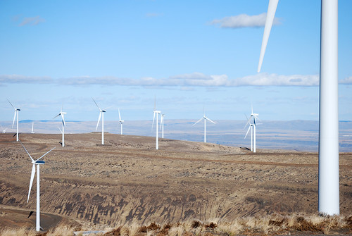
It looked really expensive, but cool.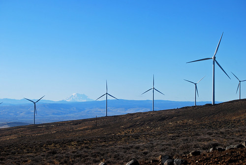
There was a visitor center on the ridge. It mentioned that these towers generated some electricity, but it wasn't really all that much. Just 337 kW for the whole art installation at the time of our visit.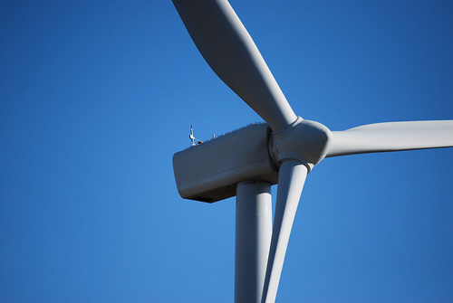
Impressive structures, though.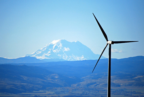
With King County's forced vote-by-mail, election totals are slow to tally. But here's an update on the two tightest races in the county:
STEVENS PASS SEWER DISTRICTI'll be sure to keep you posted!
Ballots Cast/Registered Voters: 1/9 (11.11%)
Commissioner Position No. 1 - unexpired 2-year term
- Michael Crandall: 1 (100.00%)
- Write-in: 0 (0.00%)
Commissioner Position No. 2
- Tom Maher: 1 (100.00%)
- Write-in: 0 (0.00%)

Happy Holy Day of Nokí!
She's the Goddess of Food, so you'd better be eating today. Or else She'll smack you with Her giant club o' death. Watch out!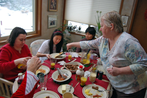
That's the way to eat. Hooray for Nokí!
"Hey, What's That?" is a cool website that will show you a panorama skyline from anywhere in the world.
Take a look at one I did for the west end of the I-90 bridge. Mt Rainier is the most prominent feature (apart from Mt Baker Ridge in Seattle), but Mt Baker is visible to the north, Mt Index to the northeast, and Tiger Mountain just visible over Mercer Island to the east.
You can click on anywhere on the map, and it will highlight the direction on the panorama, and vice versa. Click on a red triangle over a peak on the panorama and it will show you which mountain it is on the map. Can you find Glacier Peak?
On the map, if you click "Visibility cloak" in the upper right, it will shade everything you can see from the viewpoint. Then you can zoom in on Mt Rainier or wherever and see which features you can actually view from Seattle.
You can also click on "New panorama" near the top of the page and create your own!
Fun fun fun.
Down with the U.N.!
Down with the Club of Tyrants!
Down with the U.N.!
Down with the Club of Tyrants!
Happy United Nations Day!
At our house, it appears the official dahlia month is October. We have six or seven different varieties blooming right now -- even more flowers than our year-round roses!
And here's a photo: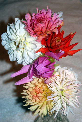
Chunlin took a business trip last week (her first!) to a convention in Raleigh. I lent her my small camera.
Unfortunately, I forgot that I'd left the camera set to take a group of sixteen photos, back to back, as one photo.
These are two of the photos she took while confusion reigned.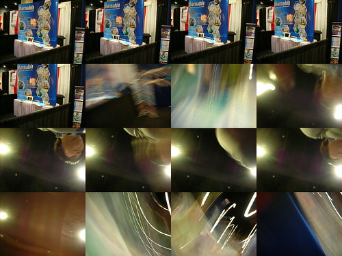
I can just imagine her asking, "What's wrong with this camera?"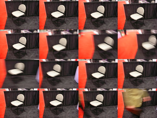
She called me at about the same time she took this picture and I quickly realized the problem, but didn't remember where in the menu she could change the setting. Luckily Chunlin found the setting (at exactly the same time that I found the right page in the manual (after downloading it)) and correct the problem.
Nice photos, though!

Heal us, o wondrous Ríhíví! Heal us with Your hot springs! Heal us with Your motherly touch!
Thank you. I promise to be nice to cats!
A good overall photo of the massive landslide in Yakima County. Many more good ones alongside it, too.
I wonder what 410 will look like when I next drive it. . .
When describing your well-being as "fine," it usually means exactly the same as a description of "okay."
On the other hand, when describing a woman as "okay," it most definitely does not mean the same thing as describing her as "fine."
If you want to make a prediction, choose something you'll still be around after, so you can gloat.
Yesterday we took a dayhike up to Headlee Pass along the Mountain Loop Highway, then stopped for dinner at a popular Mexican restaurant in Granite Falls, from which we took leftovers home. We put the leftovers in the trunk.
Once home, I opened the trunk to get the food, my backpack, boots, etc. and -- I think it was the combination of the cold air and the combined odors -- I was suddenly reminded of winter camping. . .
Apparently someone complained about at least one of my Fremont Solstice Parade photos, or the photos finally reached a popularity level so that Flickr noticed them.
Either way, this morning, Flickr informed me that they had marked all my photos as "restricted" without any precise reasoning:
Hello Sotosoroto,
We've changed the safety level of your photostream to "restricted".
As per [sic] our Community Guidelines, content like that in your account is not considered "safe" for everyone to view. You may or may not be aware that Flickr has a Safe Search system. When people browse or search on Flickr, they can filter what they see based on a safety level that they are comfortable with - either Safe Search is on, set to moderate, or off. In order for Safe Search to work, we relying on *you* to filter your content appropriately. As you upload stuff to Flickr, you need to make sure that you're applying appropriate filters (safe, moderate or restricted) and telling us what sort of content it is (photos, video, screenshots, art & illustration). If you don't apply filters correctly, there's a very good chance another member will let us know - in fact that's why we've taken action today. (No need to be upset - it's every member's right to let us know if they ever feel uncomfortable. Yours too.)
We want Flickr to be a place that everyone can enjoy. That means making sure that potentially offensive content is filtered from public, safe areas of the site. If you read our Community Guidelines, you'll see the key points are: play nice, upload things that you have created yourself, and respect the fact that there are millions of people visiting Flickr who may not see the world the same way you do. Use your common sense about whether or not your content is suitable for a global, public audience. If the answer is no, you need to filter it from public view.
You should also know that if we receive another report about your content or conduct, it's very likely we'll terminate your account.
So, please take a moment to find out how to work with safety levels, use 'em, and everybody's happy!
Regards,
Flickr Staff
What can I do to change my overall level from restricted back to safe?
I have a few dozen photos of nude men and women, but those were taken during a parade on a city street with thousands of men, women, and children in attendence, so I left them as safe.
All sexualized/nude content in your photostream needs to be classified as "restricted".
Why do non-sexualized nudes need to be "restricted"?and
What's flickr's definition of "nude," by the way?
The Flickr filters are set up so that Flickr users can choose whether they are comfortable with seeing nude content or not.
Nude/sexualized content = Female breasts, bare/thong bottom, see through topless nudity, nude body paint, pasties, Genitalia/pubic hair, etc...
That should be made clear in the content guidelines. They're very vague with the whole "grandma" thing.
Out of curiosity: Is there a difference in flickr's policy between "artsy" nudes and snapshots?
FYI: Public nudity is legal in Seattle if it is not lewd, but I know other places have stricter regulations.
Hm. That's more restrictive than the legal definition in most cities. Perhaps that should be posted in flickr's guidelines, as well.
Feel free to write back after you have made the necessary changes to your photostream.
What about people who don't mind nudity but don't want to see the hard-core graphic sex photos that dominate the "restricted" setting (gynological closeups, cum shots, etc. etc.)? Isn't that what "moderate" is for?
Unfortunately, we do not have the staff resources to continue this back and forth dialog. You have been given the parameters on how to moderate your content within the Flickr Community Guidelines. Feel free to write back after you have made the necessary changes to your photostream.
This is one of only two triple-numbered stretches of highway in Washington. This one's in Yakima. Where's the other?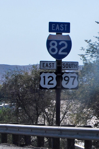
Whenever I see multiple directions on a highway sign like this, I try to calculate the resulting vector in my head. This one's almost due southeast (82+12 vs. 97). (The highway itself is running almost due south, though.)

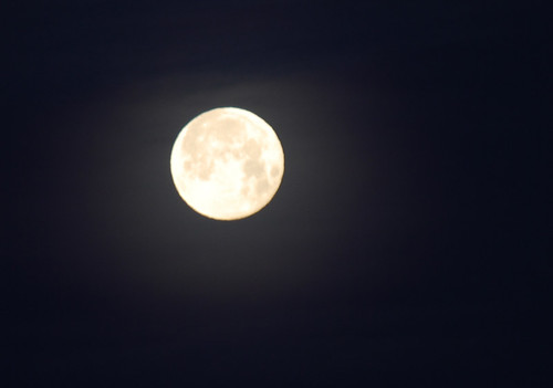
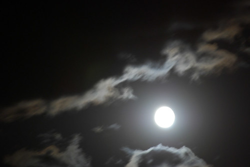
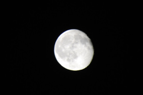
I know your calendar says today is the Holy Day of Tarénara, but the real celebration is tomorrow night, when the moon is full.
So you'd better get ready. Take your bow and arrow, go out into the woods, and dance the sacred Dance of the Hunt! Maybe you'll find a worthy stag to dance with. . . or perhaps even Tarénara's Golden Caribou doe, with antlers of gold and hooves of bronze!
Also, don't forget to take your mooncakes. Yummy, yummy mooncakes.
Can I have another mooncake, please?
Sotosoroto Husband, author, architect, king-abdicate, etc. etc. etc. |

|
California Roadtrip, Summer 2006
Light Rail Neighborhood Density
The World Does Not Agree with You
Failure Should Never Be Rewarded
Thoughts on Illegal Immigration
I'm a Native American, Dammit!
More "Global Warming" Skepticism
Giant Solar System Model along I-90
Restaurant at the End of the Universe Movie Idea