Dry Falls
Last weekend, I went to Dry Falls in eastern Washington on a Mountaineers outing. We spent two nights in cabins at Camp Delany in Sun Lakes/Dry Falls State Park. Very basic amenities, but the scenery made up for it.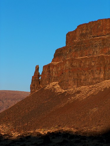
I went on a short dayhike on Saturday, wandering around the bottom of Lower Grand Coulee, up and over a gap in Umatilla Rock, halfway up Dry Falls, over to Green Lake, and to another viewpoint above Meadow Creek, and back to camp.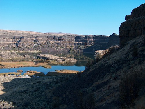
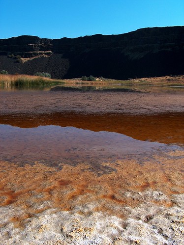
Green Lake didn't drain anywhere, so there was muddy salt flats around the edge. And it wasn't very green, either.
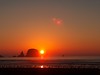
A short drive took us up to the visitors' center at the top of the cliffs.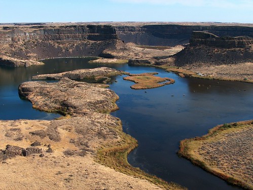
For those of you who don't know, Dry Falls and the surrounding terrain of coulees and channels were created by repeated catastrophic floods at the end of the last ice age. The cliffs in the picture above are 400 feet tall. Try to imagine 300 feet of water flowing over them.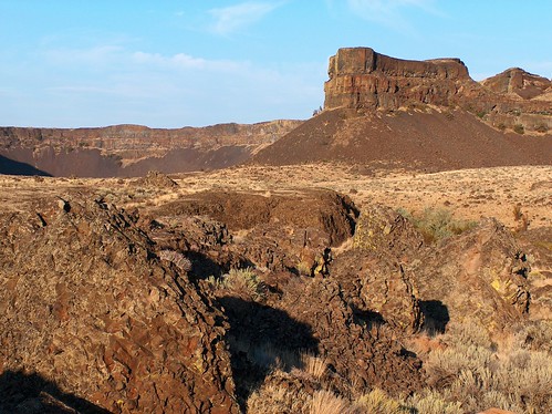
The floods left boulders scattered all across eastern Washington and even some in the Willamette valley of Oregon, south of Portland. The boulders were most likely stuck into icebergs from the disintegrating glaciers and just floated along top of the floodwaters.
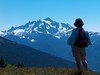
On Sunday, we drove back via SR 20 through the North Cascades. We stopped at Washington Pass. The road to the lookout was closed for the winter already, so we had to walk the half mile.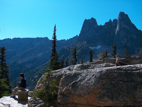
My parents have a picture from this viewpoint, with Liberty Bell Mtn (above) in the background, of me as a kid clinging to a tree that looks like it's hanging over a cliff, but my sister is standing in midair beside me. I couldn't find that tree. Maybe it died or was removed for handrail construction. Or maybe I just couldn't figure out which three-foot cliff it was on.
The larches were quite yellow up there, but none of them are near the road, so I only have distant shots.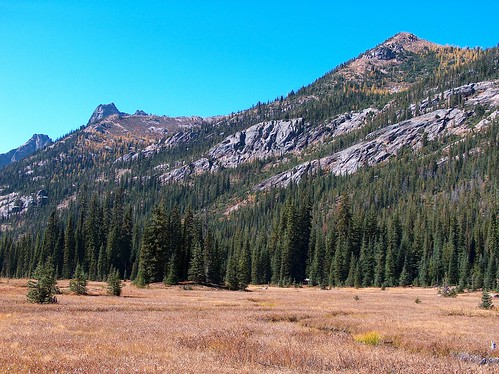
A little bit down the road is Diablo Lake.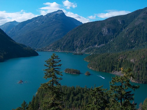
I remember, from probably that same family vacation, the four of us renting a motor boat on this lake. On the way back, my parents let me steer. I recall driving at full speed through the narrow channel between the little rock islands in the bottom left of this picture. All my mom could say was, "Mark, Mark, Mark, Mark!" I made it through just fine, thank you.
The drive back to Seattle was stop-and-go in Everett, of course, but we made it home in time for about 45 minutes to unpack and clean up before it was time to go eat Mongolian food and watch The Amazing Race. Yum yum.


2 comments:
More fabulous photos, as usual. Glad to hear you were out and about on one of the last nice autumn weekends. We scraped and repainted the front porch in the warm sunny weather.
nice photo indeed, wish that i can visit one of these place next time too.
Post a Comment