Friday, July 14, 2006

Day 16 - Seattle

Home again. Familiar, but strange. The walls are dark.

3,544 miles driven.

Thanks for watering my plants, Réní.

Thursday, July 13, 2006

Day 15 - Eugene

I've grown weary of traveling.

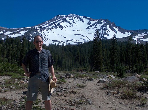
This morning, I went up to Mt. Shasta, but the last few miles of the road were closed (due to snow, I guess, but I didn't see any), so I didn't get to do the dayhike I wanted to.

But here's a picture of me as far as I got:
ShastaMe.jpg

I had considered going to Crater Lake, but I just didn't feel like it anymore. Once on I-5 northbound, I stayed on I-5 northbound. Oh well. I'll tour Oregon some other time.

Wednesday, July 12, 2006

Day 14 - Redding

Ah, back in the flat valley... Oh wait, is that a good thing?

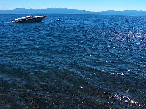
Yesterday, so very long ago, I drove the length of Lake Tahoe from state line to state line on the California side. If you're a fan of curvy mountain roads, may I suggest California Highway 89? Not only does it go past Tahoe, but the rest of it is quite a nice drive, also. And not nearly so many cars as Highway 1. 89 is a natural road, in that it goes around and over the topography instead of cutting through it.

Anyway, here are some pictures from along that road and that lake:
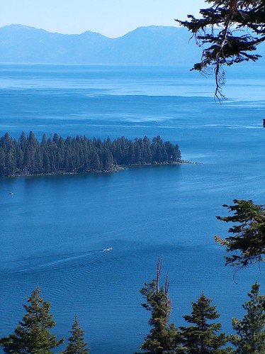
EmeraldBay

Tahoe

Northwest of Tahoe is the infamous Donner Pass, where that ill-fated group of families tried crossing the Sierra Nevada too late and got stuck for the winter. They set up several far-flung cabins in the creek valley. Some of the cabins fared better than others. A couple families had no fatalities and didn't have to eat anybody. The others didn't do so well. When the final rescue party found the last survivor, he was cannibalizing his compatriots instead of eating the oxen meat exposed by the melting snow.

Here's a picture of the monument with a 22'-high base (the depth of the snow that winter). Curiously enough, that area didn't have a winter that bad for the next hundred years.
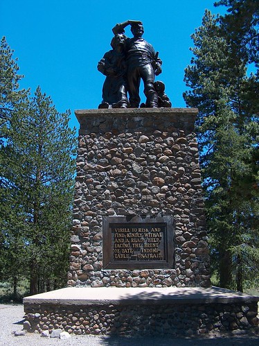
Donner

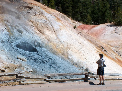
And now to today. Lassen Volcanic National Park. (Didn't it used to be a National Monument? I know Death Valley switched from Monument to Park. Why are they changing them?) The big area of bubbling sulfuric goo was closed off because of several feet of snow, but a smaller area down the hill was still accessible.
SulfurWorks
This hole was gurgling and spattering gray mud. The others steamed. ... It's probably a good thing they closed the trail to the snowed-in Bumpass Hell. We wouldn't want anybody losing the hidden boardwalk trail and slipping into a scalding vent.

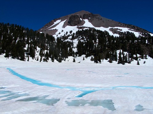
At the top of the road, the lakes still had snow and ice covering them. Here's Lassen Peak with Lake Helen in the foreground:
LassenHelen

And then down, down, down into the Central Valley. Lassen Peak on the horizon to the west, Mt. Shasta on the horizon to the north, if you can see between trees and/or buildings.


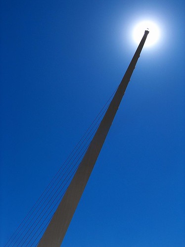
I haven't been this close to sea level since Death Valley. In Redding, there's a foot bridge spanning the Sacramento River designed by the famous Spanish architect, Santiago Calatrava. Very cool. It has a dual function, too. It's a sundial. I was there at 2:45, it told me.
Sundial

Up in the snow at Lassen was a quite comfortable temperature, but it's rather hot down here. I don't want to know the numbers.
Monday, July 10, 2006

Day 12 - South Lake Tahoe

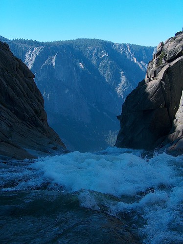
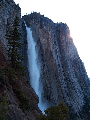
Took a little hike this morning to the top of Yosemite Falls (just about 3000' gain in 3.2 miles - but you have to walk a mile to get to the trailhead, so it's actually 4.2 or so). I started before 7:00 and thus was in the shade most of the way, and I still sweated profusely from the heat.

Here's the view halfway up (or so). This waterfall drops more than 1000'.

YosemiteFalls

And the view from the top:
YosemiteFallsTop
What was that you said about playing around the tops of waterfalls, Mom? Trust me, I didn't go down to the dangerous portion.


I've now driven north to Tahoe, obviously from the title of the post. I was three nights in the Yosemite area. It had been five days since I filled my gas tank. Back on the southbound portion, I was filling my tank maybe twice a day. Felt good to drive again. I took a sideroad (highway 89, if you're keeping score) instead of US 395, because it is curvier.

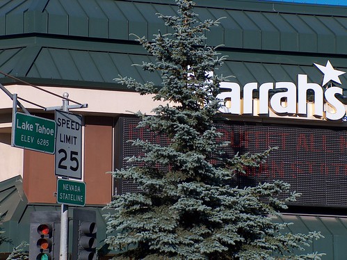
Here's the stateline between California and Nevada:
Stateline
Note the casino.

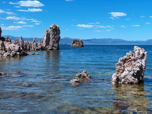
And now we delve into the distant past to show some photos. Two or three days ago, as I arrived in the Yosemite area, I stopped by Mono Lake, which has some odd salt-and-springs-created rock features.
MonoLake

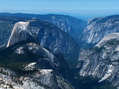
Remember how I climbed Clouds Rest for the best view in the park? Here's one-tenth of that view:
YosemiteValley

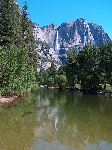
Yesterday, down in the valley, here's a view looking up at the same falls as above:
YosemiteMerced

I've hiked 40 miles in the past five days, most of that with a full pack. I was planning on doing another overnight backpacking trip tomorrow, but I just might pass. Am I lazy or just ready to move on?

Sunday, July 09, 2006

Day 11 - Yosemite Valley

This keyboard is insane. It's just little buttons with a lot of space between them. And the shift keys are in weird places... And it's quite hot in here.

I went to Clouds Rest yesterday. Great view, 360 degrees. I didn't recognize Half Dome at first because I was looking down at it. Tons of mosquitos (that's an actual estimate of the combined weight of all the mosquitos that tried to bite me (or succeeded) in the past 36 hours). Yosemite has a thing or two to learn about trail maintenance. Mud and fallen logs and creek-trail abound. Sadly, the campsites up there didn't have views. Almost the entire hike was in trees.

Down here in the valley, signage is a problem. As are their map-making skills. But, as before, great views. Thundering waterfalls cascading down from semi-infinite heights. Towering cliffs in all directions. Not so many mosquitos, but still rather hot. At least the Ahwahnee restaurant had good air conditioning. And great food. I caught the brunch buffet. Mmmmmm... buffet...

You might have noticed that I haven't shown you any photographs. That would be the computer. Although I can see my photos, I can't post them. The "browse" feature from Explorer is disabled for security reasons.

I think I need to go sit on an air-conditioned bus for a while.

Friday, July 07, 2006

Day 9 - Bishop

Did you expect to hear from me again?

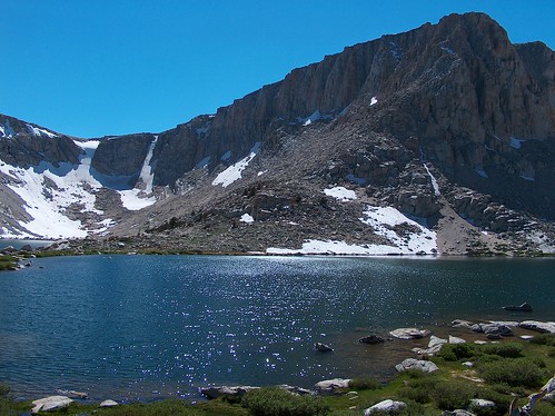
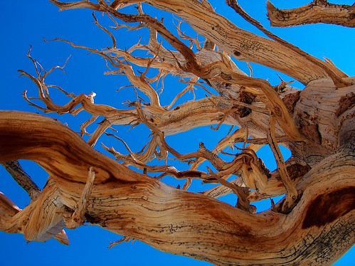
I just got back down the hill from backpacking to Cottonwood Lakes in the John Muir Wilderness. Lovely lakes and snow-touched peaks. Lots -- I mean LOTS -- of bugs. But most weren't the biting kind. Just the careful-or-you-might-inhale-a-dozen kind. But I picked a campsite on a slight rise and the wind took care of most of that.

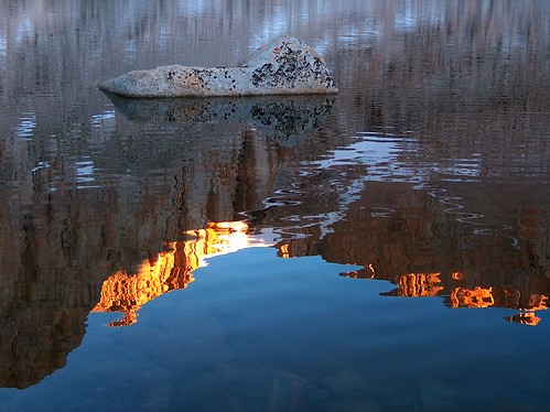
Cottonwood4

Cottonwood5Tree

Cottonwood5

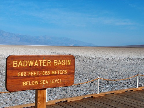
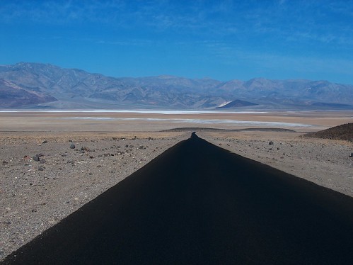
Let's see... Before Cottonwood Lakes was Death Valley. The night before, I stayed in Shoshone, which is plenty desert for me. Then the road crests a small pass and suddenly there's a huge, deep, gaping hole in front of me. That would be Death Valley. I got out of there before noon.

Badwater

DeathValley

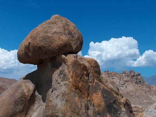
Outside of Lone Pine (the portal to Mt Whitney (and Cottonwood Lakes)) are the Alabama Hills. At first, they look like huge piles of dirt sitting in the middle of the valley, but they actually have some quite nice rock formations when you get up close.

AlabamaHills

The day before that, I drove from Santa Barbara to Shoshone, without stopping for much. Lots of traffic on I-15, then I turn north at Barstow and suddenly the world is empty once again.

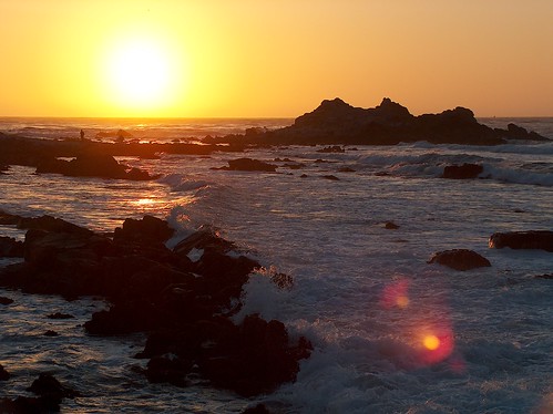
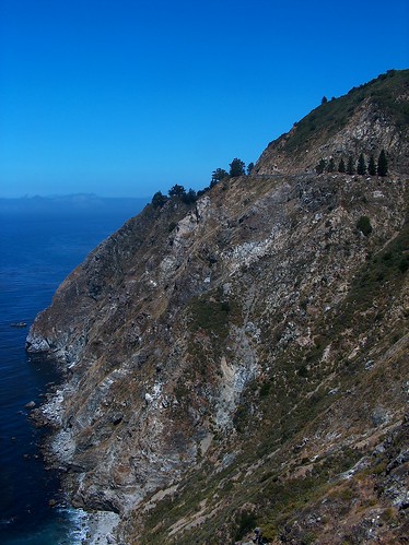
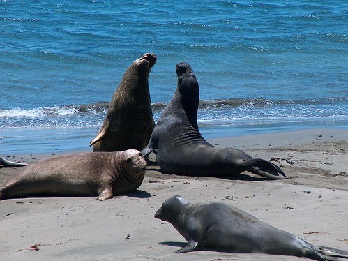
Way back when, along the coast, I posted a few pictures on Flickr but couldn't blog, so here they are. The first is sunset at Monterey, then a typical Big Sur coastline (do you see the highway?), and finally some elephant seals.


PointPinos

BigSur

PiedrasBlancas

Sunday, July 02, 2006

Day 4 - Monterey

The drive between San Jose and Santa Cruz was stop-and-go for much of the way. And then there was a several-mile-long backup when the freeway dwindles to a two-lane road between Santa Cruz and Monterey. And then I lost one of my rechargable batteries for my camera under my driver's seat and I can hear it rolling around but it's in this plastic case thing that I've never noticed before and thus I can't reach it. I think I'll have to buy a new set of batteries. I've been taking so many pictures, I bought a 2-gig memory card in San Jose. I've already used up one of my 1-gig cards. . .

Anyway, Monterey:

Dinner?

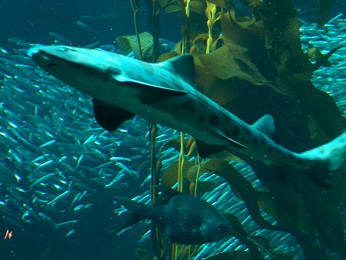
Shark!!!!

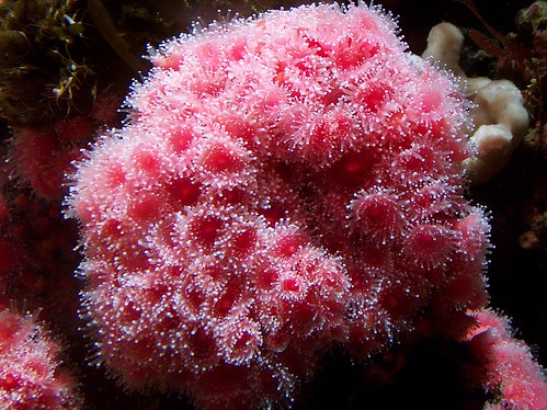
PrettyFlowers

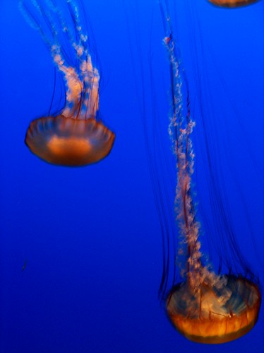
Jelly

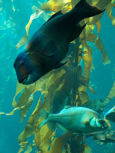
Fish and jellyfish are difficult to photograph, since for some reason the aquarium keeps it really dark in there. . .

Saturday, July 01, 2006

Day 3 - San Francisco

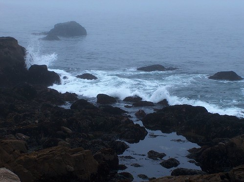
Drive down the coast a ways. Some drivers don't read the signs that say "Slow Vehicles Use Turnouts," but I survived all right. I stopped at a state park to see harbor seals, but there weren't any there. Just waves and rocks and birds.

GerdleCove

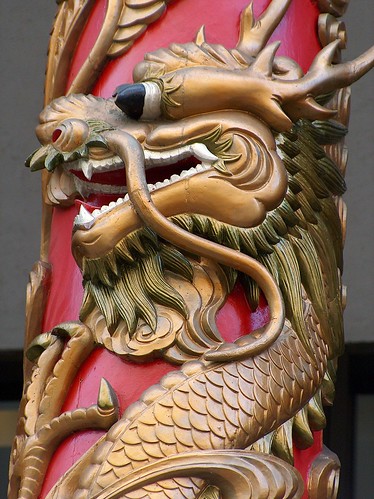
After a brief stop in Sausilito to see a scale model of San Francisco Bay, I crossed the Golden Gate Bridge into San Francisco. I stored my car and checked in to a hostel. Then I proceeded to wander town. Chinatown:
Chinatown

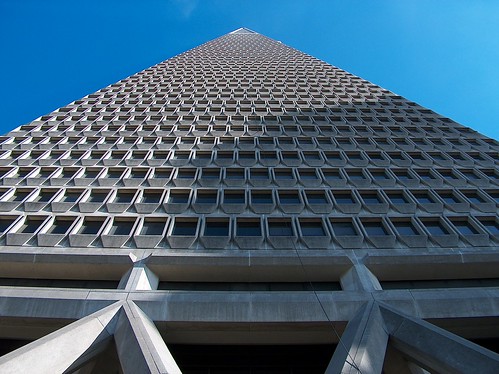
And just down the hill, the TransAmerica Pyramid:
TransAmerica

It's very tall.

Friday, June 30, 2006

Day 2 - Mendocino

Mendocino has the city-as-art-gallery concept down pat. Ferndale (up the road) and La Conner (in Washington) don't got nothing on this place. ... Doesn't mean I'm into it, though.

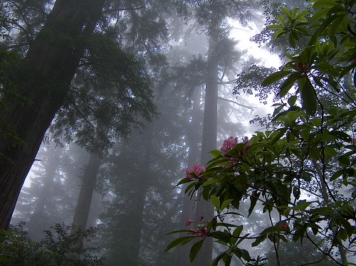
I skipped a few of the redwood sights along the way down, since I got plenty of trees up in the national park. Like so:
RhododendronRedwood

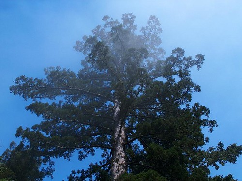
And:
BaldHill

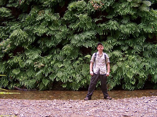
And here are the ferns (and me) at Fern Canyon:
Ferns

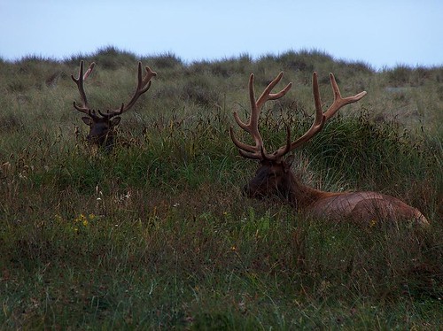
And the elk near the exit of Fern Canyon:
Elk

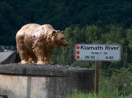
The bridge over the Klamath River, near Klamath:
BearBridge

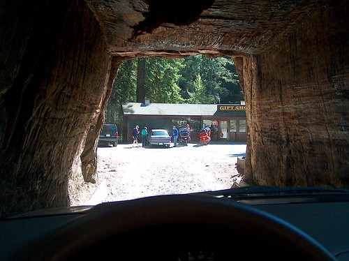
I did go to the Drive-Thru Tree in Leggett, however. How could I resist?
Leggett

It's not really all that small of a hole. The car ahead of me was a Lincoln! It's just a big tree. Note the gift shop beyond. . . I went in, but bought nothing.

Highway 1 so far is a blast to drive. Plenty of curves and twists to make any non-driver a bit queasy.

Day 2 - Eureka

Tall, tall trees. This computer has been dumbed-down, so I won't be able to show you pictures, but you'll have to believe me. The redwoods make the twenty-foot-tall rhododendrons look tiny. Still some in bloom. It's still quite foggy, so the Redwood Creek overlook was not much of an overlook. The Lady Bird Johnson grove was quite satisfactory in the crane-your-neck department. The tops of the trees were lost in the mists.

Fern Canyon is also a marvelous place. Fifty-foot-high sheer walls covered in maidenhair ferns, with a flat, thirty-foot-wide gravelly creek running between. Giant redwoods and lesser trees have fallen off the cliffs and lie askew at the bottom, still leaning on the far wall. One tree actually flipped when it fell and speared itself into the ground, rootball up in the air.

Day 2 - Crescent City

Maybe I should call it "Day 1" since I'll be leaving town soon, but it's day 2 now, so day 2 I'll write.

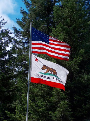
Greetings from California!!

BearFlag.jpg

I left Seattle yesterday at 7 a.m., hit a little traffic at the Ship Canal Bridge, and turned off the freeway in Grants Pass, Oregon, at 2 p.m. Rolled in to Crescent City, California around 4:30. Cloudy and cool.

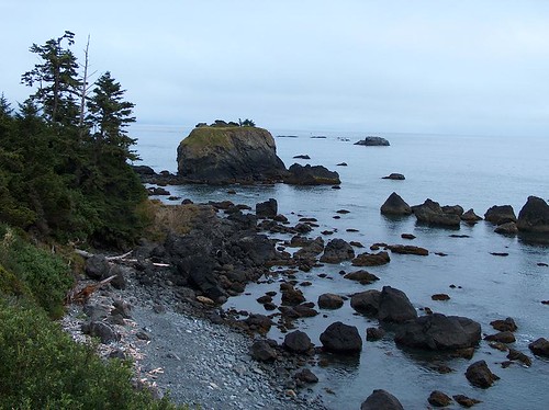
CrescentCity.jpg

Not much to do in town after 5 p.m. except go to the shore. Well, maybe the movie theater or bowling alley were open.... Anyway, this morning it's time to move on. I was planning on driving out of town, but then I saw that this cafe was open, so I stopped in to see if they had a computer, and they did, and I'm using it. But enough of that. ... But maybe a scone first.

Happy Friday!

Wednesday, June 28, 2006

Three-Oh

Today is my thirtieth birthday on the Narakan calendar (tomorrow on the Gregorian). It's kinda anticlimatic, actually. Just another day.

I had someone tell me recently that I look like I'm 26 years old, but act much older. I think I've been acting over thirty for many years now.

Today is, of course, also the Holy Day of Píríuso, the God of the Sun, which makes me want to quote from a Bruce Springsteen song that Manfred Mann's Earth Band popularized:

Mama always told me not to look into the eyes of the sun
But Mama, that's where the fun is

Some brimstone baritone anticyclone rolling stone preacher from the East
Says, "Dethrone the dictaphone. Hit it in its funnybone. That's where they expect it least."


Okay, maybe only the first part of that was relevant. . .